Exploring Hunga-Tonga Hunga-Ha’apai Volcanic Island Before the Eruption
2022 Update:
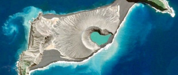
When we had the privilege of exploring Hunga-Tonga, Hunga-Ha’apai before its destruction by the 2022 eruption. When we sailed there, it was an almost-new land form, having been formed by an earlier 2014 eruption. The erosion of waves and wind continued to change its form; the beautiful black sand barrier between the mineral green lake and ocean had disappeared by 2021 allowing sea water into the crater.
You can see by this time-lapse how the island changed in the weeks leading up to the recent eruption. When we were there, it was more or less in the shape of the November 17, 2021 satellite image.
This is our drone video and pictures taken sitting by the edge of the volcano’s crater lake which is in the middle of the island shown in November 2021. This caldera or crater was probably where the massive eruption began…talk about being in the wrong place at the right time!
<.
At about 4.20am local time (3.10pm GMT on 13 January 2022, the Hunga-Tonga, Hunga-Ha’apai volcano erupted, sending plumes of ash, steam and gas up to miles high into the atmosphere. Below is a satellite image of volcano erupting
Currently, communication with Tonga is still down. A few satellite phones on the islands have gotten out some information, and the news is grave. Several people were swept out to sea by the resulting tsunami. We continue to pray for everyone affected by the eruption and tsunami. Here’s my original posting from October 2017.
2017 Exploration of Hunga-Tonga Hunga-Ha’apai:
We think of the world as mapped. In our post-satellite/GPS world, everything on the earth’s surface (and even a lot that’s under the water) is known. Right? Maybe not.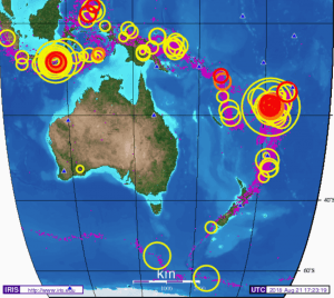
Good Charts and Navigation are Essential
Sailing around the world on Golden Glow, crossing oceans on dark, moonless nights, moving the boat in vision-crippling fog, we must rely on our instruments and a multitude of navigation aides including our boat’s built-in furuno navigation system, radar, printed charts, and sophisticated apps to ensure we don’t hit anything. It’s comforting to think our navigation tools give us accurate information about every land mass and reef in our path. Our lives may depend on it. But we’ve learned it’s safest not to assume that charts are accurate or give us the full picture. We download and carefully study satellite imagery before charting every South Pacific course. And yet, in this area of the South Pacific known as the “Ring of Fire,” we can’t rely entirely even on satellite imagery.
The Ring of Fire Is Stirring Up Intense Seismic Activity
You’ve probably read about the recent spate of intense volcanic eruptions and earthquakes in Indonesia, Vanuatu, Fiji and Tonga. We have to consider current seismic activity as we navigate to be aware of undersea earthquakes and volcanoes and what they spawn: tsunamis, pumice that can disable our engines, new land masses, and even super-heated water from undersea fissures and eruptions. Recently, in Tanna, Vanuatu, there was a hot spring along the shore near where we were anchored. Normally, we’d turn that into a spa-day, but we were warned by locals to stay away because the water was too hot and sulfuric to be safe.
Hunga Tonga – a new Island to Explore
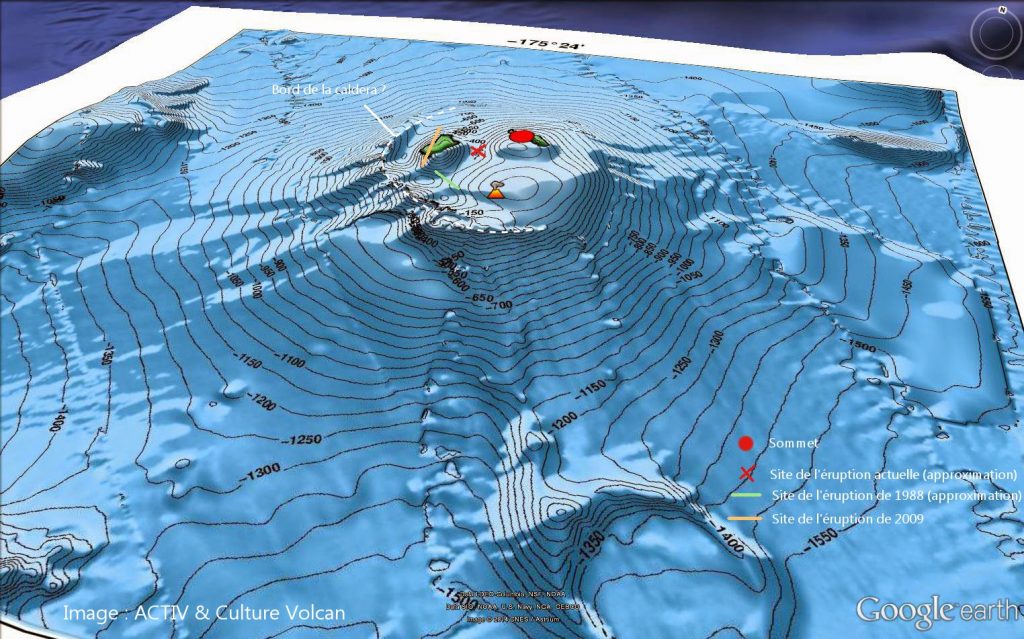
This map shows the underwater topography of the seabed around Hunga Tonga. The caldera is the white dotted line and the eruptions are marked in red.
In Tonga, Rand and I explored an island that was less than two years old – and not on most of our charts or satellite images. Southwest of the Ha’apai region of Tonga, two small islands became one when an undersea eruption threw up so much magma from deep within the earth that it filled in all the ocean between the two old islands and created a new island called Hunga Tonga.
Magma is formed as two tectonic plates melt together under high heat and pressure, and the super-heated rock is forced to the surface. Hunga Tonga is on the most seismically active ocean ridge on earth, with the highest density of submarine volcanoes.
Exploring a New Island
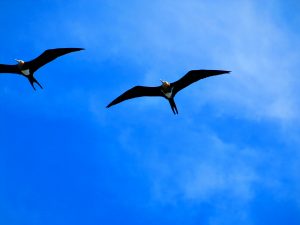
frigate birds seemed to own Hunga Tonga

it doesn’t take long for the ocean’s trash to wash up new land
We decided to stop by Hunga Tonga to check it out on our sail from Tonga to New Zealand as it was right on our rhumb line. Other than a large turtle, whose tracks we saw heading up the beach, and numerous sea birds, we were alone on this new volcanic island in the South Pacific. Sadly, even in its short life, this island has already managed to accumulate a fair amount of trash that’s washed ashore like these plastic bottles.
As we neared Hunga Tonga, the sea started to glisten with pumice in the water. Was this run-off from the islands, or fresh pumice coming up through fissures under the sea still blowing off steam? We also saw long, cylindrical creatures in the water (resembling jelly fish but unlike any we’d seen before). We anchored in a bay off a beach that looked like it was dark sand. But when we went ashore, we realized the sand was actually finely-pulverized, volcanic rock.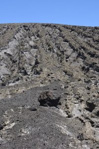
We were drawn to the tall ash cone that rose up the now dormant crater of this volcano. But climbing it was easier said than done. Wind and rain had eroded the cone into tapering tightrope paths of ash that slipped away under our feet. Threading our way toward the top, the risk grew and grew of us sliding off the narrowing path into the canyons that dropped off steeply on either side. At one point I got down on my knees to crawl along thinking that would give me a greater chance of getting to the summit. Have you ever felt how sharper-than-glass fresh volcanic rock is…my knees cried out for me to quickly abandon my foolish idea!
Fortunately, we had brought our drone with us and we used it to check out the view from the top of the crater. We also were able to walk the long way around the base of the cone to the other side where our efforts were rewarded by a discovery of a bright green lake. I didn’t dare touch the water. My thinking was that nothing good for the skin could come in that shade of green.
Along the edge of the lake you can see the deeply eroded sides of the eruption’s cone.
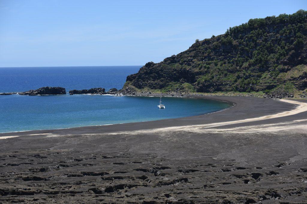
that’s Golden Glow anchored off the black volcanic beach on Hunga Tonga
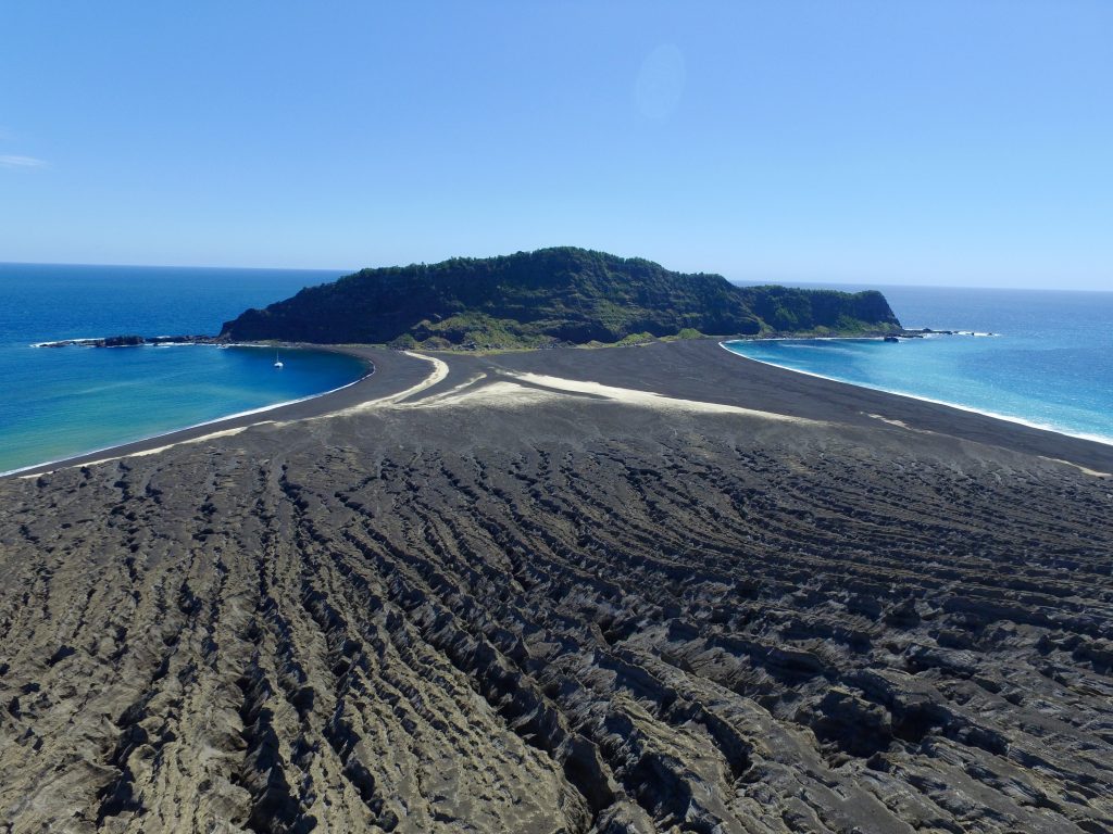
view from up high on the volcano’s cone, overlooking the bay where we anchored
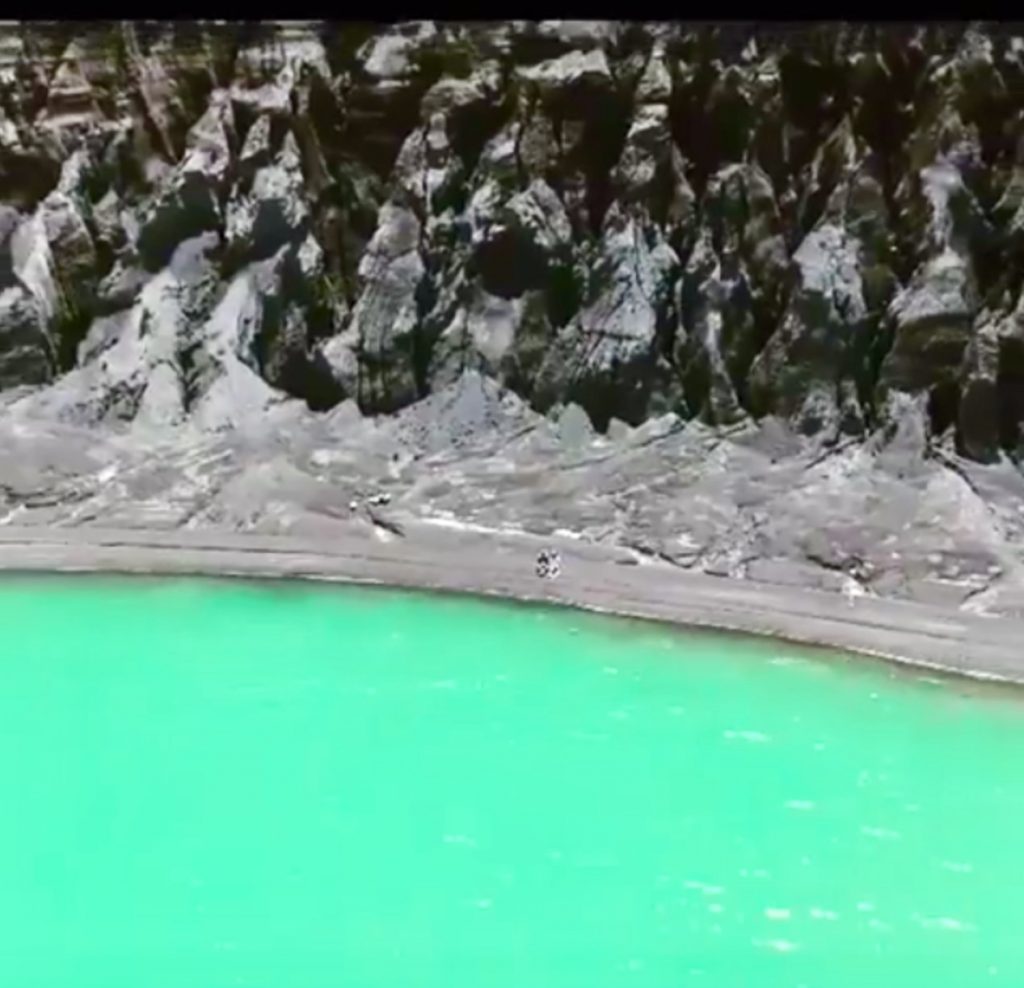
Rand and I sit beside the bright green volcanic lake
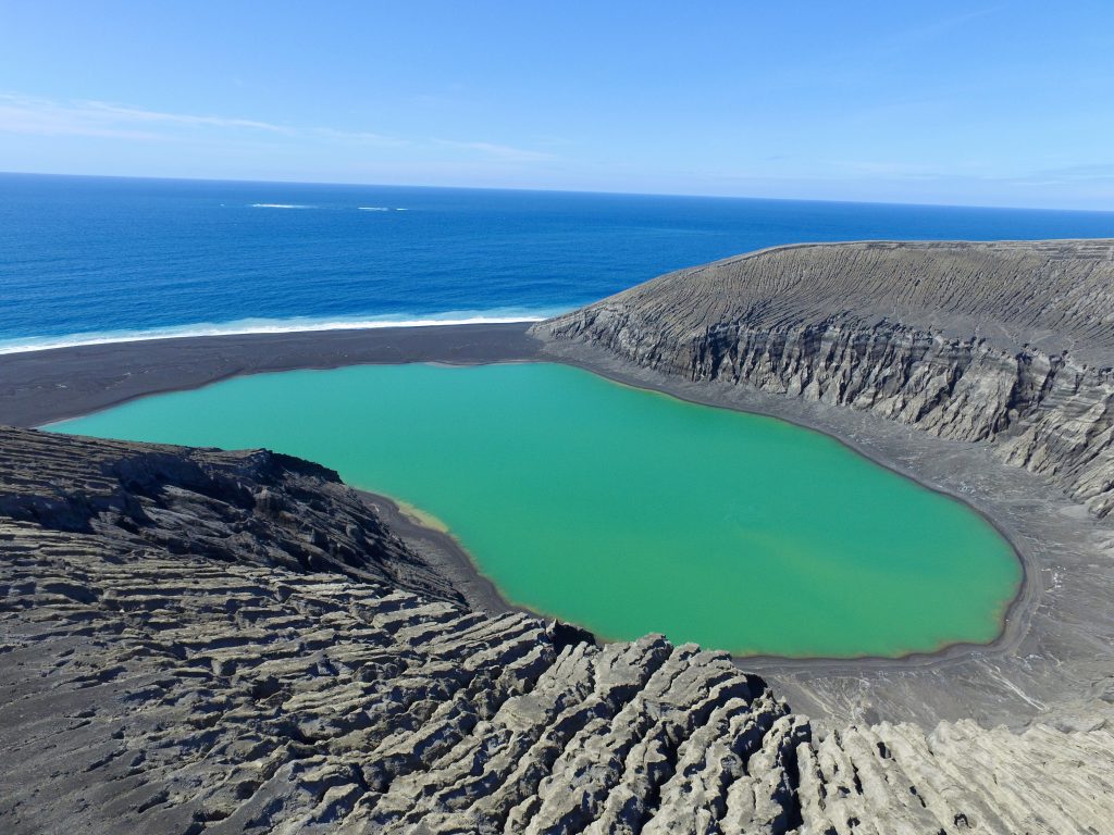
Looking down on the bright green volcanic lake from the top of the caldera

Walking Hunga Tonga was a bit like walking on the moon.

The eruption that formed Hunga Tonga in 2014 was intense and violent (Nasa photo)


Crazy there is trash on brand new islands! And good to know for navigation when we get to the South Pacific!!
I agree, Cally. In the most remote Tuamotos atolls, Chesterfield reefs of New Caledonia, and even on this almost new land formation, we saw so much man-made debris – sneakers, bottles, buoys, netting, PLASTIC. We saw a lot of styrofoam in the way-north Atlantic too near Greenland when we sailed to Europe. Stay safe and have FUN on your Pacific sail!!